Alto Alegre, Roraima
Municipality in North, Brazil
Flag
Coat of arms

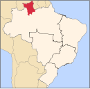
Location in Roraima state
(2020 [1])
Alto Alegre (Portuguese pronunciation: [ˈawtu aˈlɛɡɾi]) is a city in the Brazilian state of Roraima. The population in 2020 was 15,380, and the area is 25,567 km².[2] Its limits are Amajari to the north, Boa Vista in the east, Mucajaí and Iracema in the south, and Venezuela in the west.
Alto Alegre was founded by Pedro Costa, a gold miner. In 1982, it became an independent municipality.[3] It can be accessed from the RR-205 highway from Boa Vista.[4]
The municipality contains part of the Roraima National Forest.[5]
References
- ^ IBGE 2020
- ^ "IBGE | Cidades | Roraima | Alto Alegre". cidades.ibge.gov.br. Retrieved 2016-06-15.
- ^ "Alto Alegre". IBGE (in Portuguese). Retrieved 15 April 2021.
- ^ "sobre Alto Alegre". Municipality of Alto Alegre (in Portuguese). Retrieved 15 April 2021.
- ^ Características da UC (in Portuguese), ICMBio, retrieved 2016-05-19
External links
- Official website (in Portuguese)
 Media related to Alto Alegre (Roraima) at Wikimedia Commons
Destinations from Alto Alegre | |
|---|---|


 | This Roraima, Brazil location article is a stub. You can help Wikipedia by expanding it. |
- v
- t
- e


