Aparhant
Village in Southern Transdanubia, Hungary

Coat of arms
 Hungary
 (2022)[1]
7186
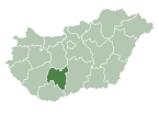
Aparhant is a village in Tolna County, Hungary.
A little village in suburban Hungary, surrounded with breathtaking countryside. It has lovely views of hills and forests in the not so distant Mecsek.
The chief occupations are agriculture and horticulture.
The education system provides only primary educations, with village inhabitants needing to travel further out for a secondary education.
The population is around 1200 people.
It is known as the highest internet users in the country per capita.
External links
- Street map (in Hungarian)
References
- ^ a b c "Aparhant". Detailed Gazetteer of Hungary. Hungarian Central Statistical Office. Retrieved 2024-01-15.

| ||
|---|---|---|
| City with county rights |
|   |
| Towns | ||
| Large villages | ||
| Villages |
| |
| Other topics |
| |
 | This Tolna location article is a stub. You can help Wikipedia by expanding it. |
- v
- t
- e


