Central Island
UNESCO World Heritage Site in Kenya
3°29′30″N 36°4′0″E / 3.49167°N 36.06667°E / 3.49167; 36.06667IUCN category II (national park)
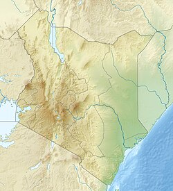

Location of Central Island in Kenya
Central Island, also known as Crocodile Island, is a volcanic island located in the middle of Lake Turkana in Kenya. It is also the location of Central Island National Park, which is governed by the Kenya Wildlife Service.[1]
Overview
Central Island is composed of more than a dozen craters and cones, three of which are filled by small lakes. The two largest lakes partially fill craters up to a kilometre wide and about 80 m deep, the floors of which are near sea level. The highest point on the dominantly basaltic island reaches 550 m, about 190 m above the lake surface. An E-W-trending chain of small explosion craters cuts the eastern side of the 3-km-wide island. Several small islands to the SE represent partially submerged crater rims, and other cones and lava plugs lie beneath the lake surface near the island.
The youngest Central Islands tuffs and lavas may be as young as Holocene (Karson and Curtis, 1992). Fumarolic activity is concentrated along the NE-to-SE rim of the central crater, and sprays of sulfur from the fumaroles were observed by visitors in the 1930s. In 1974 intense emission of molten sulfur and steam clouds were seen from the mainland.[2]
References
External links
- Kenya Wildlife Service – Central Island National Park
- Cheetah Revolution Safaris - Central Island National Park
- v
- t
- e
- Aberdare
- Amboseli
- Arabuko Sokoke
- Central Island
- Chyulu Hills
- Hell's Gate
- Kora
- Lake Nakuru
- Malka Mari
- Marsabit
- Meru
- Mount Elgon
- Mount Kenya
- Mount Longonot
- Nairobi
- Ol Donyo Sabuk
- Ruma
- Saiwa Swamp
- Sibiloi
- South Island
- Tsavo East
- Tsavo West
and reserves
| Authority control databases: Geographic |
|
|---|
 | This Kenya location article is a stub. You can help Wikipedia by expanding it. |
- v
- t
- e


