Cranborne Chase and West Wiltshire Downs
Area of Outstanding Natural Beauty in England

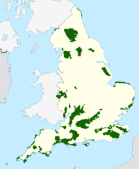
Cranborne Chase and West Wiltshire Downs is an Area of Outstanding Natural Beauty (AONB) covering 379 square miles (980 km2) of Dorset, Hampshire, Somerset and Wiltshire. It is the sixth largest AONB in England.
The area was designated as an AONB in 1981 and confirmed in October 1983.[1] Since 2014, the AONB Partnership of local authorities has used the abbreviated name Cranborne Chase AONB in its promotion of the area.[2]
The AONB includes several distinct landscape areas, among them:
- Cranborne Chase, an area of chalk downland in the south.[3]
- West Wiltshire Downs, an area of chalk downland in the north.[4]
- The Vale of Wardour, a wide clay valley between the two areas of downland.[5]
- The area around Stourhead and Longleat on the Somerset-Wiltshire border, which has a distinctive characteristic of upper greensand hills.[5]
Much of the landscape is farmed chalk downland. The people who populated the area thousands of years ago constructed Ackling Dyke and the Knowlton Circles. The area was later the scene of conflict in the Civil War, seeing the destruction of Old Wardour Castle. Other features include the Larmer Tree Gardens at Tollard Royal; and Fovant, where soldiers training during the First World War cut regimental badges into the chalk hillside.
The AONB includes two large blocks of woodland, Grovely Wood and Great Ridge Wood.
References
- ^ Rouse, E (July 2008). "Cranborne Chase and West Wiltshire Downs Historic Landscape Characterisation Project". Cranborne Chase and West Wiltshire Downs AONB Partnership with English Heritage. Retrieved 2022-10-09.
- ^ "CRANBORNE CHASE PARTNERSHIP PLAN 2019-2024 (Page 8)" (PDF). Cranborne Chase and West Wiltshire Downs AONB Partnership. Retrieved 2022-10-09.
- ^ "National Character Area 134 - Dorset Downs and Cranborne Chase". Natural England. Retrieved 2022-10-09.
- ^ "National Character Area 132 - Salisbury Plain and West Wiltshire". Natural England. Retrieved 2022-10-09.
- ^ a b "National Character Area 133 - Blackmore Vale and Vale of Wardour". Natural England. Retrieved 2022-10-09.
External links
- Cranborne Chase AONB Woodfair
- Historic landscape characterisation - explore the history and archaeology of the AONB
- v
- t
- e
- Chichester Harbour
- Chilterns
- Cotswolds
- Cranborne Chase and West Wiltshire Downs
- High Weald
- Isle of Wight
- Kent Downs
- North Wessex Downs
- Surrey Hills
- Former: East Hampshire1
- South Hampshire Coast2
- Sussex Downs1
the Humber
- 1 Now part of South Downs National Park
- 2 Now part of New Forest National Park
- 3 Partly in Wales
50°58′N 2°02′W / 50.96°N 2.04°W / 50.96; -2.04
 | This article about a location in Wiltshire is a stub. You can help Wikipedia by expanding it. |
- v
- t
- e


