Ese Odo
LGA in Ondo State, Nigeria
6°13′03″N 4°57′52″E / 6.2174°N 4.9645°E / 6.2174; 4.9645 Nigeria
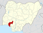
Ese Odo is a Local Government Area in Ondo State, Nigeria, populated by the Ijaw (Izon) ethnic sub groups of the Western Apoi tribe and the Arogbo tribe.[1] Its headquarters are in the town of Igbekebo. The biggest towns within this Local Government Area are Arogbo, Igbobini, Agadagba-Obon, and Igbekebo.
It has an area of 762 km2 and a population of 154,978 at the 2006 census.[citation needed]
The postal code of the area is 352.[2]
References
2. https://nigeriazipcodes.com/5965/list-of-towns-and-villages-in-ese-odo-lga/. Retrieved 2019-12-16.
- v
- t
- e
Ondo StateState capital: Akure
- Akoko North-East
- Akoko North-West
- Akoko South-East
- Akoko South-West
- Akure North
- Akure South
- Ese Odo
- Idanre
- Ifedore
- Ilaje
- Ile Oluji/Okeigbo
- Irele
- Odigbo
- Oka
- Okitipupa
- Ondo East
- Ondo West
- Ose
- Owo
 | This Ondo State, Nigeria location article is a stub. You can help Wikipedia by expanding it. |
- v
- t
- e


