Kerecsend
Village in Northern Hungary, Hungary
47°47′46″N 20°20′35″E / 47.79611°N 20.34306°E / 47.79611; 20.34306 Hungary
 (1 Jan. 2015)
3396
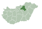
Kerecsend is a village in Heves County, Northern Hungary Region, Hungary.
Geography
The village is located on the northern part of the Great Hungarian Plain, 14 km south from Eger in Heves county.
Communications
Kerecsend is on Road 3 and here starts the Road 25.
Sights to visit
- Church
References
- ^ "Kerecsend települési választás eredményei". Retrieved 2019-05-13.
External links
![]() Media related to Kerecsend at Wikimedia Commons
Media related to Kerecsend at Wikimedia Commons
- Official website in Hungarian
- v
- t
- e
- Eger (county seat)

- Abasár
- Adács
- Aldebrő
- Andornaktálya
- Apc
- Átány
- Atkár
- Balaton
- Bátor
- Bekölce
- Besenyőtelek
- Boconád
- Bodony
- Boldog
- Bükkszék
- Bükkszenterzsébet
- Bükkszentmárton
- Csány
- Demjén
- Detk
- Domoszló
- Dormánd
- Ecséd
- Egerbakta
- Egerbocs
- Egercsehi
- Egerfarmos
- Egerszalók
- Egerszólát
- Erdőkövesd
- Erdőtelek
- Erk
- Fedémes
- Feldebrő
- Felsőtárkány
- Gyöngyöshalász
- Gyöngyösoroszi
- Gyöngyössolymos
- Gyöngyöstarján
- Halmajugra
- Heréd
- Hevesaranyos
- Hevesvezekény
- Hort
- Istenmezeje
- Ivád
- Kápolna
- Karácsond
- Kerecsend
- Kisfüzes
- Kisnána
- Kömlő
- Kompolt
- Ludas
- Maklár
- Markaz
- Mátraballa
- Mátraderecske
- Mátraszentimre
- Mezőszemere
- Mezőtárkány
- Mikófalva
- Mónosbél
- Nagyfüged
- Nagykökényes
- Nagyréde
- Nagytálya
- Nagyút
- Nagyvisnyó
- Noszvaj
- Novaj
- Ostoros
- Parádsasvár
- Pálosvörösmart
- Pély
- Petőfibánya
- Poroszló
- Rózsaszentmárton
- Sarud
- Sirok
- Szajla
- Szarvaskő
- Szentdomonkos
- Szihalom
- Szilvásvárad
- Szúcs
- Szűcsi
- Tarnabod
- Tarnalelesz
- Tarnaméra
- Tarnaörs
- Tarnaszentmária
- Tarnaszentmiklós
- Tarnazsadány
- Tenk
- Terpes
- Tiszanána
- Tófalu
- Újlőrincfalva
- Vámosgyörk
- Váraszó
- Vécs
- Visonta
- Visznek
- Zagyvaszántó
- Zaránk
- History
- Geography
- Government
- Economy
- Culture
- Tourism
 | This Heves county location article is a stub. You can help Wikipedia by expanding it. |
- v
- t
- e


