Melangguane Airport
Airport

MNA
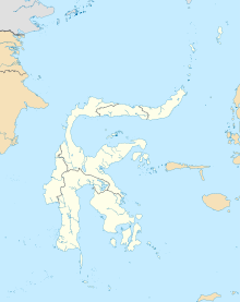
Location in Sulawesi
Show map of Sulawesi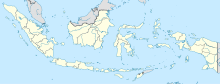
MNA
Location in Indonesia
Show map of Indonesia| Direction | Length | Surface | |
|---|---|---|---|
| m | ft | ||
| 18/36[1] | 1,598 | 5,243 | Asphalt |
Melangguane Airport, also known as Melonguane Airport (Indonesian: Bandar Udara Melonguane) (IATA: MNA, ICAO: WAMN) is an airport serving the city of Melangguane, located within the Talaud Islands Regency, part of the province of North Sulawesi on the island of Karakelong in Indonesia. It is operated by the Ministry of Transportation.
Airlines and destinations
| Airlines | Destinations |
|---|---|
| Wings Air | Manado, Tahuna |
Facilities
The airport resides at an elevation of 5 metres (16 ft) above mean sea level. It has one runway designated 18/36 with an asphalt surface measuring 1,598 by 30 metres (5,243 ft × 98 ft).
References
- v
- t
- e
| Banten |
|
|---|---|
| Jakarta |
|
| West Java | |
| Central Java | |
| Yogyakarta | |
| East Java | |
| Aceh |
|
|---|---|
| North Sumatra | |
| West Sumatra | |
| Riau |
|
| Riau (Islands) | |
| Jambi | |
| Bengkulu |
|
| South Sumatra |
|
| Bangka–Belitung | |
| Lampung |
|
| West Kalimantan | |
|---|---|
| Central Kalimantan |
|
| South Kalimantan |
|
| East Kalimantan | |
| North Kalimantan | |
| South Sulawesi | |
|---|---|
| West Sulawesi | |
| Southeast Sulawesi | |
| Central Sulawesi | |
| Gorontalo | |
| North Sulawesi |
|
| Bali | |
|---|---|
| West Nusa Tenggara | |
| East Nusa Tenggara | |
| Maluku | |
|---|---|
| North Maluku | |
| Papua | |
|---|---|
| Central Papua | |
| Highland Papua | |
| South Papua | |
| Southwest Papua | |
| West Papua | |
Names in bold are international airports; names of international airports marked with ‡ have Visa on Arrival (VoA) facility
 | This article about an Indonesian airport is a stub. You can help Wikipedia by expanding it. |
- v
- t
- e
 | This North Sulawesi location article is a stub. You can help Wikipedia by expanding it. |
- v
- t
- e


