Mount Tecumseh
Mountain in New Hampshire, United States
43°58′02″N 71°33′29″W / 43.9672911°N 71.5581329°W / 43.9672911; -71.5581329[2]
Mount Tecumseh is a mountain located in Grafton County, New Hampshire. The mountain is named after the Shawnee leader Tecumseh (c. 1768–1813), and is a part of the White Mountains. The east side of Tecumseh drains into the Mad River; the west side drains into several brooks. All are tributaries of the Pemigewasset River, which drains into the Merrimack River and thence into the Gulf of Maine in Massachusetts.
Mount Tecumseh is the site of the Waterville Valley Resort, one of the largest ski areas in New Hampshire.
Long believed to stand 4,003 feet in height, Mt. Tecumseh was the lowest on the Appalachian Mountain Club list of "four-thousand footers." As of July 2019, however, a new survey marker on the summit indicates an elevation of 3,997 feet.[3]
Gallery
-
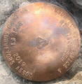 A survey marker on the summit indicates a new elevation of 3,997 feet.
 -
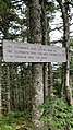 A sign on the trail up to the summit of Mt. Tecumseh.


See also
 New Hampshire portal

References
- ^ a b "Mount Tecumseh, New Hampshire". Peakbagger.com. Retrieved February 22, 2013.
- ^ "Mount Tecumseh". Geographic Names Information System. United States Geological Survey, United States Department of the Interior. Retrieved February 22, 2013.
- ^ Hudson, Marshall (November 14, 2019). "A 4,000-footer Controversy". New Hampshire Magazine. Retrieved May 24, 2021.
External links
- "Hiking Mount Tecumseh". Appalachian Mountain Club.
- "Mt. Tecumseh". HikeTheWhites.com.
- "Mt. Tecumseh". FranklinSites.com Hiking Guide
- v
- t
- e
- Bayle Mountain
- Larcom Mountain
- Mount Roberts
- Mount Shaw
- Mount Whittier
- Nickerson Mountain
- Turtleback Mountain
- Blue Job Mountain
- Crotched Mountain
- Gap Mountain
- Little Monadnock Mountain
- Lovewell Mountain
- Moose Mountain
- Mount Assurance
- Mount Cardigan
- Mount Kearsarge
- Mount Kelsey
- Mount Magalloway
- Mount Monadnock
- Mount Sunapee
- Pitcher Mountain
- Potanipo Hill
- Ragged Mountain
- Skatutakee Mountain
- Smarts Mountain
- Tenney Mountain
- Thumb Mountain
- Uncanoonuc Mountains
 | This New Hampshire state location article is a stub. You can help Wikipedia by expanding it. |
- v
- t
- e


