National Cycle Route 8
Route of the National Cycle Network in Wales

National Cycle Route 8 (or NCR 8) is a route of the National Cycle Network, running from Cardiff to Holyhead. The route passes through the heart of Wales, and is also known as Lôn Las Cymru (Welsh for 'Wales' green lane'). It is largely north–south from Holyhead to Cardiff or Chepstow, and in total measures some 400 km (250 mi) in length. Some of its route follows the trackbed of former railway lines, such as Lôn Las Menai, Lôn Eifion, the Mawddach Trail and the Taff Trail; in other places, the route is on public highways.
Both ends are easily accessible via the rail network.
Route

Cardiff to Brecon
This largely follows the Taff Trail:
Cardiff | Pontypridd | Abercynon | Merthyr Tydfil | Brecon
Alternative: Chepstow to Glasbury
Lon Las Cymru provides an alternative south route for those coming into Wales from the Severn Bridge, following Route 42 from Chepstow to Glasbury, where it joins Route 8:
Chepstow | Usk | Abergavenny | Glasbury
There is also a small loop at the top of Route 42 providing links to Hay-on-Wye.
Brecon to Machynlleth
Brecon | Talgarth | Glasbury | Erwood | Builth Wells | Newbridge on Wye | Llanwrthwl | Rhayader | Llangurig | Llanidloes | Staylittle | Machynlleth
Machynlleth to Porthmadog
Machynlleth | Dolgellau | Trawsfynydd | Penrhyndeudraeth | Porthmadog
Porthmadog to Holyhead
Porthmadog | Penygroes | Caernarfon | Bangor | Holyhead
External links
- Sustrans map and description - north section
- Sustrans map and description - south section
- Wales Trails
- A map of the route
- v
- t
- e
routes
routes
- 125
- 136
- 137
- 141
- 151
- 155
- 162
- 164
- 165
- 166
- 167
- 168
- 169
- 172
- 174
- 177
- 178
- 179
- 195
- 196
- 207
- 208
- 212
- 221
- 222
- 223
- 224
- 231
- 232
- 235
- 236
- 244
- 246
- 248
- 250
- 253
- 254
- 255
- 256
- 264
- 267
- 270
- 272
- 273
- 274
- 275
- 276
- 277
- 278
- 305
- 326
- 334
- 338
- 339
- 341
- 344
- 403
- 410
- 413
- 416
- 423
- 425
- 426
- 436
- 437
- 438
- 439
- 440
- 442
- 446
- 447
- 448
- 451
- 455
- 461
- 465
- 466
- 467
- 468
- 469
- 475
- 476
- 477
- 478
- 481
- 482
- 485
- 492
- 523
- 524
- 525
- 526
- 533
- 534
- 535
- 536
- 539
- 544
- 547
- 548
- 549
- 550
- 552
- 554
- 555
- 558
- 559
- 561
- 562
- 566
- 568
- 573
- 576
- 577
- 585
- 622
- 627
- 633
- 636
- 645
- 646
- 647
- 648
- 656
- 657
- 658
- 665
- 668
- 672
- 674
- 677
- 680
- 688
- 689
- 696
- 697
- 699
- 700
- 715
- 725
- 753
- 754
- 756
- 764
- 765
- 766
- 767
- 768
- 775
- 776
- 777
- 780
- 810
- 811
- 818
- 819
- 820
- 822
- 825
- 862
- 881
- 882
- 883
- 884
- 885
- 887
routes
- C2C
- Celtic Trail
- Clyde to Forth
- Colliers Way
- Cornish Way
- Darent Valley Path
- Forth and Clyde Canal Pathway
- Hadrian's Cycleway
- Heron Trail
- Keelmans Way
- Lôn Cambria
- Lôn Las Ogwen
- Pennine Cycleway
- Mercian Way
- The North West Trail
- Salmon Run cycle route
- Scunthorpe Ridgeway
- Sheerness Way
- Trans Pennine Trail
- Viking Coastal Trail
- Way of the Roses
- White Rose cycle route
- W2W
- Yorkshire Wolds cycle route
Transport in Powys | |||||||
|---|---|---|---|---|---|---|---|
| Road | 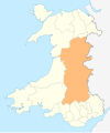 | ||||||
| Footpaths | |||||||
| Cycle routes |
| ||||||
| Railway stations |
| ||||||
| |||||||
Transport in Rhondda Cynon Taf | ||
|---|---|---|
| Roads |  | |
| Bus | ||
| Cycling |
| |
| Railway lines | ||
| Railway stations | ||
| ||
| ||
|---|---|---|
| Motorways and A roads |  | |
| Pedestrian precincts and commercial streets | ||
| Bus | ||
| Cycling | ||
| Railway lines | ||
| Railway operators |
| |
| Major railway stations | ||
| Other city railway stations | ||
| Air | ||
| Water | ||
| Proposed transport network |
| |
 Transport portal Transport portal Wales portal Wales portal | ||
Transport in Monmouthshire | ||
|---|---|---|
| Road |  | |
| Bus | ||
| National Cycle Network | ||
| Railway lines | ||
| Railway stations | ||
| Waterways | ||
| ||
53°18′32″N 4°37′59″W / 53.309°N 4.633°W / 53.309; -4.633
 | This United Kingdom road or road transport-related article is a stub. You can help Wikipedia by expanding it. |
- v
- t
- e


