North Col
Mountain pass in the Himalayas


North Col
North Col
The North Col (Chinese: 北坳; pinyin: Běi Ào; Tibetan: Chang La) refers to the sharp-edged pass carved by glaciers in the ridge connecting Mount Everest and Changtse in Tibet. It forms the head of the East Rongbuk Glacier.
When climbers attempt to climb Everest via the North ridge (Tibet), the first camp on the mountain itself (traditional Camp IV, modern Camp I) is established on the North Col. From this point at approximately 7,020 metres (23,030 ft) above sea level, climbers ascend the North Ridge to reach a series of progressively higher camps along the North Face of Everest. Climbers make their final push to the summit from Camp VI at 8,230 metres (27,001 ft) altitude.[1]
The North Col was first climbed by George Mallory, Edward Oliver Wheeler, and Guy Bullock on 24 September 1921, during the British reconnaissance expedition. This was the first time a Westerner had set foot on Mount Everest. Although long credited to Mallory, discovery of the North Col was in fact made by Wheeler about a week before Mallory confirmed its existence while searching for possible routes to the summit of Mount Everest. All subsequent expeditions in the 1920s and 1930s attempted to reach the summit of Everest by using the North Col.[2]
Before 1950, most Everest expeditions went from Tibet and via the North Col, but most now go from Nepal via the South Col. In 1951, two mountaineers on the 1952 British Cho Oyu expedition, Edmund Hillary and George Lowe, crossed the Nup La Col, and "like a couple of naughty schoolboys" went deep into Chinese territory, down to Rongbuk and round to the old prewar Camp III beneath the North Col.[3]


Overview
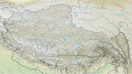
This map is inverted; south is up and north is down. The North Col is lower than South Col, and farther from the Everest peak.

North Col
See also
- South Col
- Sagarmatha National Park
- Geology of the Himalaya
- Geography of China
References
- ^ "North Col of Mount Everest". NASA.
- ^ Peter Gillman, ed. (1993). Everest - The Best Writing and Pictures from Seventy Years of Human Endeavour. Little, Brown and Company. pp. 24–25. ISBN 0-316-90489-9.
- ^ George Lowe and Huw Lewis-Jones, The Conquest of Everest: Original Photographs from the Legendary First Ascent (London: Thames and Hudson, 2013) (pages 23,212) ISBN 978-0-500-54423-5
External links
Wikimedia Commons has media related to North Col.
Wikiquote has quotations related to North Col.
- Painting of the Camp on North-Col
- Description of the climbing route to the summit via the North Col
- v
- t
- e
and landmarks
- Base Camp
- Geneva Spur
- Hillary Step
- Hornbein Couloir
- Kangshung Face (East Face)
- Kangshung Glacier
- Khumbu Glacier
- Khumbu Icefall
- Lhakpa La
- Lho La
- North Col
- North Face
- Norton Couloir
- Rongbuk Glacier
- South Col
- South Summit
- Three Pinnacles
- Three Steps
- Western Cwm

- 1921 British reconnaissance
- 1922 British
- 1924 British (Affair of the Dancing Lamas)
- 1933 British aerial reconnaissance
- 1933 British
- 1935 British
- 1936 British
- 1938 British
- 1950–52 British–Swiss–US reconnaissance
- 1951 British
- 1952 Swiss
- 1953 British
- 1960 Chinese
- 1975 British SW Face
- 1976 British–Nepalese SW Face
- 1979 Yugoslav West Ridge
- 1996 Indo-Tibetan Border Police
- 2006 Philippine
- 2007 Altitude Everest expedition
- Earth Day 20 International Peace Climb
- Mallory and Irvine Research Expedition
- Beyond the Edge
- The Climb (book)
- The Climb (2007 film)
- The Epic of Everest
- Everest (1998 film)
- Everest (2015 film)
- Everest (Indian TV series)
- Everest '82
- Everest: Beyond the Limit
- EverestMax
- Expedition Everest (roller coaster)
- Into Thin Air
- The Man Who Skied Down Everest
- Mount Everest webcam
- Paths of Glory
- Peak
- The Conquest of Everest
- The Wildest Dream
- Wings Over Everest
Mountain passes of China | |||||||||||||||||||
|---|---|---|---|---|---|---|---|---|---|---|---|---|---|---|---|---|---|---|---|
| On the border |
| ||||||||||||||||||
| In the interior |
| ||||||||||||||||||
| |||||||||||||||||||


 | This Tibet location article is a stub. You can help Wikipedia by expanding it. |
- v
- t
- e


