Pactola Lake
Reservoir in Pennington County, South Dakota
44°04′23″N 103°29′35″W / 44.073°N 103.493°W / 44.073; -103.493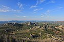  |
| Southwestern South Dakota |
|---|
| Sculptures |
|
| Geologic and natural history |
|
| Mountains |
|
| Caves |
|
| Forests and wildernesses |
| Lakes |
|
| Scenic byways |
| Historic sites |
|
|
Pactola Lake is the largest and deepest reservoir in the Black Hills, located 15 miles west of Rapid City, South Dakota, United States. Constructed in 1952, the dam and waters are managed by the Bureau of Reclamation, with the surrounding land managed by the US Forest Service as part of Black Hills National Forest, which operates a visitor center located on the south side of the dam.[2] Facilities include campgrounds, hiking trails, picnic areas, cliffs, and a beach.[1][3]
History
Pactola Dam was built in 1952 by federal authorities to provide Rapid City with a new water supply, following the related construction of Deerfield Dam in 1945.[4] The new reservoir inundated the mining town of Pactola,[5] and construction was completed in 1956 after the movement of more than 4.3 million cubic yards of embankment fill. Severe thunderstorms in 1972 that caused flooding in Rapid City led to dam modifications to ensure safety, with further safety modifications in 1987.[3]
Ecology
Many fish live in Pactola Lake, including lake and brown trout as well as perch and bass.[1][6] An invasive zebra mussel infestation was detected in the summer of 2022.[7][8]
Recreation
Visitors can go boating, camping, swimming, and hiking.[1] The lake is popular with fishermen, and scuba divers can see the limited remains of the town of Pactola.[6]
See also
References
- ^ a b c d e f "Pactola Reservoir Complex". United States Forest Service. Retrieved August 27, 2022.
- ^ Wesolick, Eric (June 6, 2024). "South Dakota Tribes tell their story at Pactola". KOTA TV. Retrieved June 8, 2024.
- ^ a b "Pactola Dam & Reservoir Flood Control, Irrigation & Recreation". The Historical Marker Database. Retrieved August 27, 2022.
- ^ "Water for a Thirsty West The Rapid Valley Unit & Project". The Historical Marker Database. Retrieved August 27, 2022.
- ^ "Geographic Names Information System". edits.nationalmap.gov. Retrieved August 27, 2022.
- ^ a b Gwaldis, Melissa. "Diving South Dakota's Lakes: Pactola Reservoir, Lake Francis Case, And Lake Oahe". Just Gotta Dive. Retrieved August 27, 2022.
- ^ "Zebra Mussel Discovered in Pactola Reservoir". gfp.sd.gov. Retrieved August 27, 2022.
- ^ Thompson, Nathan (July 14, 2022). "Zebra mussels discovered in Pactola Reservoir". Rapid City Journal. Retrieved August 27, 2022.
External links
Wikimedia Commons has media related to Pactola Lake.
- Pactola (Ghost town)


