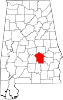
Pine Level, Montgomery County, Alabama
Unincorporated community in Alabama, United States
32°04′05″N 86°03′35″W / 32.06806°N 86.05972°W / 32.06806; -86.05972 (2007)
36069
Pine Level, also known as Pine Tucky, is an unincorporated community in Montgomery County, Alabama, United States. Pine Level is located along U.S. Route 231 (also known as Alabama State Route 53), 25 miles (40 km) southeast of Montgomery.
History
Pine Level was originally known as Pine Tucky, most likely due to its location on poor sandy soil covered with pine trees. The community later began to be called Pine Level.[2] A post office first opened under the name Pine Level in 1839.[3]
Notable people
- Rosa Parks, her arrest served as a catalyst to the Montgomery bus boycott during the Civil Rights Movement. She lived in Pine Level as a child.
- Claudette Colvin, arrested for refusing to give up her seat on a segregated bus, nine months before Rosa Parks was arrested for doing the same thing. She lived in Pine Level until she was 8-years-old.
References
- ^ "Pine Level". Geographic Names Information System. United States Geological Survey, United States Department of the Interior.
- ^ Foscue, Virginia (1989). Place Names in Alabama. Tuscaloosa: The University of Alabama Press. p. 111. ISBN 0-8173-0410-X.
- ^ "Montgomery County". Jim Forte Postal History. Retrieved January 18, 2015.
- v
- t
- e
Municipalities and communities of Montgomery County, Alabama, United States
County seat: Montgomery
communities
‡This populated place also has portions in an adjacent county or counties
- Alabama portal
- United States portal
 | This Montgomery County, Alabama state location article is a stub. You can help Wikipedia by expanding it. |
- v
- t
- e


