Rostraver Airport
Airport in Pennsylvania, United States
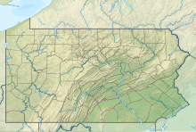

FWQ
Location of airport in Pennsylvania
Show map of Pennsylvania
FWQ
FWQ (the United States)
Show map of the United States| Direction | Length | Surface | |
|---|---|---|---|
| ft | m | ||
| 8/26 | 4,002 | 1,220 | Asphalt |
| Aircraft operations (year ending 5/3/2021) | 43,920 |
|---|---|
| Based aircraft | 45 |
Source: Federal Aviation Administration[1]
Rostraver Airport (ICAO: KFWQ, FAA LID: FWQ, formerly P53) is a public use airport in Westmoreland County, Pennsylvania, United States.[1]
Geography
It is located five nautical miles (9 km) east of the central business district of Monongahela, Pennsylvania[1] in Rostraver Township. It is operated by the Westmoreland County Airport Authority, which also operates the Arnold Palmer Regional Airport in Unity Township, Pennsylvania.
This airport is assigned a three-letter location identifier of FWQ by the Federal Aviation Administration, but it does not have an International Air Transport Association (IATA) airport code.[1][2][3]
Facilities and aircraft
Rostraver Airport covers an area of 300 acres (120 ha) at an elevation of 1,228 feet (374 m) above mean sea level. It has one asphalt paved runway designated 8/26 which measures 4,002 by 75 feet (1,220 x 23 m).[1]
For the 12-month period ending May 3, 2021, the airport had 43,920 aircraft operations, an average of 120 per day: 98% general aviation, 2% air taxi and <1% military. At that time there were 45 aircraft based at this airport: 40 single-engine, 4 multi-engine, and 1 glider.[1]
See also
References
- ^ a b c d e f FAA Airport Form 5010 for FWQ PDF, effective 2023-09-07.
- ^ "Airline and Airport Code Search". International Air Transport Association (IATA). Retrieved November 14, 2016.
- ^ "Rostraver Airport (IATA: none, ICAO: KFWQ, FAA: FWQ)". Great Circle Mapper. Retrieved November 14, 2016.
External links
 Aviation portal

- Westmoreland County Airport Authority
- Rostraver Airport (P53) at Pennsylvania DOT Bureau of Aviation
- FAA Terminal Procedures for FWQ, effective May 16, 2024
- Resources for this airport:
- FAA airport information for FWQ
- AirNav airport information for FWQ
- FlightAware airport information and live flight tracker
- SkyVector aeronautical chart for FWQ
- v
- t
- e
| in Maryland | |
|---|---|
| in Ohio | |
| in Pennsylvania | |
| in West Virginia |

15k–50k
(in 2010)
 Category


