San Angelo, Texas metropolitan area
Metropolitan Statistical Area in Texas, United States
San Angelo metropolitan area | ||
|---|---|---|
Metropolitan Statistical Area | ||
| San Angelo, TX MSA | ||
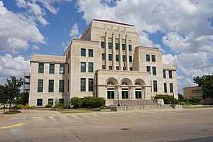 San Angelo City Hall | ||
 Interactive Map of San Angelo, TX CSA
| ||
| Country |  United States United States | |
| State |  Texas Texas | |
| Largest city | San Angelo | |
| Time zone | UTC-6 (CST) | |
| • Summer (DST) | UTC-5 (CDT) | |
The San Angelo metropolitan statistical area (MSA) is a metropolitan area in West Texas that covers two counties - Tom Green and Irion. As of the 2010 census, the MSA had a population of 111,823,[1] with a 2014 estimate of 118,182.[2]
Counties
- Irion
- Tom Green
Communities
Cities
- San Angelo (principal city)
- Mertzon
Census-designated places
Unincorporated places
Demographics
As of the census[3] of 2020, 122,888 people, 47,794 households, and 28,198 families were residing within the MSA. The racial makeup of the MSA was 65.8% White (non-Hispanic White 52.4%), 3.7% African American, 0.9% Native American, 1.5% Asian, and 17.6% from other races. Hispanics or Latinos of any race were 38.9% of the population.
See also
- List of cities in Texas
- List of museums in West Texas
- Texas census statistical areas
- List of Texas metropolitan areas
References
- ^ "Profile of General Population and Housing Characteristics: 2010 (CBSA-EST2009-01)". 2010 Population Estimates. United States Census Bureau, Population Division. Archived from the original (CSV) on 2019-05-21. Retrieved 2010-07-22.
- ^ "Profile of General Population and Housing Characteristics: 2010 (CBSA-EST2009-01)". 2010 Population Estimates. United States Census Bureau, Population Division. Archived from the original (CSV) on May 21, 2019. Retrieved July 22, 2010.
- ^ "U.S. Census website". United States Census Bureau. Retrieved 2008-01-31.
- v
- t
- e
Austin (capital)
- Ark‑La‑Tex
- Big Bend
- Boca Chica
- Blackland Prairies
- Brazos Valley
- Central Texas
- Coastal Bend
- Concho Valley
- Cross Timbers
- East Texas
- Edwards Plateau
- Golden Triangle
- Hill Country
- Llano Estacado
- Northeast Texas
- North Texas
- Osage Plains
- Panhandle
- Permian Basin
- Piney Woods
- Rio Grande Valley
- Southeast Texas
- South Plains
- South Texas
- Texoma
- Trans-Pecos
- West Texas
areas
- Abilene
- Amarillo
- Austin–Round Rock (Greater Austin)
- Beaumont–Port Arthur
- Brownsville–Harlingen
- College Station–Bryan
- Corpus Christi
- Dallas–Fort Worth–Arlington (DFW)
- El Paso
- Houston–The Woodlands–Sugar Land (Greater Houston)
- Killeen–Temple
- Laredo
- Longview
- Lubbock
- McAllen–Edinburg–Mission
- Midland
- Odessa
- San Angelo
- San Antonio–New Braunfels
- Sherman–Denison
- Texarkana
- Tyler
- Victoria
- Waco
- Wagner Creek
- Wichita Falls
 Texas portal


