Scheduled monuments in Birmingham
There are thirteen scheduled monuments in Birmingham, England.
In the United Kingdom, a scheduled monument is a "nationally important" archaeological site or historic building that has been given protection against unauthorised change by being placed on a list (or "schedule") by the Secretary of State for Culture, Media and Sport; English Heritage takes the leading role in identifying such sites.[1] Monuments are defined in the Ancient Monuments and Archaeological Areas Act 1979 and the National Heritage Act 1983. Scheduled monuments—sometimes referred to as scheduled ancient monuments—can also be protected through listed building procedures, and English Heritage considers listed building status to be a better way of protecting buildings and standing structures.[1] A scheduled monument that is later determined to "no longer merit scheduling" can be descheduled.[2]
List
Birmingham's scheduled monuments are:[3]
| Name | Location | Type | Completed [note 1] | Date designated | Grid ref.[note 2] Geo-coordinates | Notes | Entry number [note 3] | Image | Ref. | Wikidata |
|---|---|---|---|---|---|---|---|---|---|---|
| Burnt mound in Fox Hollies Park | Fox Hollies | Burnt mound | 24 July 2002 | SP 12471 82177 52°26′15″N 1°49′05″W / 52.4374°N 1.8180°W / 52.4374; -1.8180 (Burnt mound in Fox Hollies Park) | 140m south east of Round Pool | 1020541 |  More images | [4] | Q17601480
| |
| Moated site, Gannow Green | Gannow Green | Moated site | 12 November 1962 | SO 98448 78393 52°24′13″N 2°01′27″W / 52.4035°N 2.0242°W / 52.4035; -2.0242 (Moated site, Gannow Green) | 700m east of Gannow Green Farm | 1017810 |  | [5] | Q17601536
| |
| Guillotine Lock, Stratford Canal | King's Norton | Guillotine lock | 1814 (1814) | SP 05582 79473 52°24′48″N 1°55′10″W / 52.4132°N 1.9194°W / 52.4132; -1.9194 (Guillotine Lock, Stratford Canal) | 1005885 |  | [6] | Q17601543
| ||
| Hawkesley Farm moated site | Moated site | SP 01761 77589 52°23′47″N 1°58′32″W / 52.3963°N 1.9755°W / 52.3963; -1.9755 (Hawkesley Farm moated site) | 1005909 | 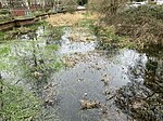 | [7] | Q17601544
| ||||
| Kent's Moat | Moated site | SP 14386 86262 52°28′27″N 1°47′23″W / 52.4741°N 1.78964°W / 52.4741; -1.78964 (Kent's Moat) |  | Q17601548
| ||||||
| King's Standing Bowl Barrow | Kingstanding | Bowl barrow | Late Neolithic/ Late Bronze Age | 9 October 1981 | SP 08049 95597 52°33′29″N 1°52′58″W / 52.5580°N 1.8827°W / 52.5580; -1.8827 (King's Standing Bowl Barrow) | 1016437 |  | [8] | Q6411111
| |
| Burnt mounds at Moseley Bog | Moseley | Burnt mounds | 24 July 2002 | SP 09343 82043 52°26′10″N 1°51′47″W / 52.436°N 1.863°W / 52.436; -1.863 (Burnt mounds at Moseley Bog) | 380m north east of Moseley New Pool; coordinates are approx | 1020542 |  More images | [9] | Q17601551
| |
| Moated site, Peddimore Hall | Sutton Coldfield | Moated site | 1659 (1659) | 15 December 1997 | 52°32′27″N 1°46′34″W / 52.5407778°N 1.7760028°W / 52.5407778; -1.7760028 (Moated site, Peddimore Hall) | Now a private residence | 1017648 | 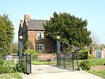 | [10] | Q17601556
|
| Perry Bridge | Perry Barr | Bridge | 1711 (1711) | SP 07079 91936 52°31′31″N 1°53′50″W / 52.52534°N 1.89711°W / 52.52534; -1.89711 (Perry Bridge) | 1002980 |  More images | [11] | Q7169729
| ||
| Medieval deer park and other archaeological remains in Sutton Park | Sutton Park | Deer park | 30 June 1971 | SP 08966 96072 52°33′42″N 1°51′14″W / 52.56174°N 1.85392°W / 52.56174; -1.85392 (Medieval deer park and other archaeological remains in Sutton Park) | Also SP 09976 98407, SP 10486 96699 | 1020420 |  More images | [12] | Q17601623
| |
| Weoley Castle | Weoley Castle (district) | Remains of a fortified manor house | SP 02165 82757 52°26′34″N 1°58′11″W / 52.4428°N 1.9698°W / 52.4428; -1.9698 (Weoley Castle) | 1005905 |  More images | [13] | Q7983099
| |||
| Burnt mounds in Woodlands Park | Burnt mounds | 24 July 2002 | SP 03438 80247 52°25′13″N 1°57′03″W / 52.4202°N 1.9509°W / 52.4202; -1.9509 (Burnt mounds in Woodlands Park) | 540m and 640m west of The Pavilion; also SP 03530 80299 | 1020540 |  | [14] | Q17601559 |
Notes
- ^ The date given is the date used by Historic England as significant for the initial building or that of an important part in the structure's description.
- ^ Sometimes known as OSGB36, the grid reference is based on the British national grid reference system used by the Ordnance Survey.
- ^ The "List Entry Number" is a unique number assigned to each listed building and scheduled monument by Historic England.
References
- ^ a b "The Schedule of Monuments". Pastscape. English Heritage. Retrieved 14 October 2012.
- ^ "Scheduled Monuments". English Heritage. Retrieved 15 October 2012.
- ^ "Birmingham's Scheduled Ancient Monuments". Birmingham City Council. Retrieved 24 August 2014.
- ^ Historic England. "Details from listed building database (1020541)". National Heritage List for England. Retrieved 24 August 2014.
- ^ Historic England. "Details from listed building database (1017810)". National Heritage List for England. Retrieved 24 August 2014.
- ^ Historic England. "Details from listed building database (1005885)". National Heritage List for England. Retrieved 24 August 2014.
- ^ Historic England. "Details from listed building database (1005909)". National Heritage List for England. Retrieved 24 August 2014.
- ^ Historic England. "Details from listed building database (1016437)". National Heritage List for England. Retrieved 24 August 2014.
- ^ Historic England. "Details from listed building database (1020542)". National Heritage List for England. Retrieved 24 August 2014.
- ^ Historic England. "Details from listed building database (1017648)". National Heritage List for England. Retrieved 24 August 2014.
- ^ Historic England. "Details from listed building database (1002980)". National Heritage List for England. Retrieved 24 August 2014.
- ^ Historic England. "Details from listed building database (1020420)". National Heritage List for England. Retrieved 24 August 2014.
- ^ Historic England. "Details from listed building database (1005905)". National Heritage List for England. Retrieved 24 August 2014.
- ^ Historic England. "Details from listed building database (1020540)". National Heritage List for England. Retrieved 24 August 2014.
Map all coordinates using OpenStreetMap
Download coordinates as:
- KML
- GPX (all coordinates)
- GPX (primary coordinates)
- GPX (secondary coordinates)
- v
- t
- e
 Buildings and structures in Birmingham, England
(in height order)
- Sutton Coldfield mast
- BT Tower
- 10 Holloway Circus
- Chamberlain Clock Tower
- Alpha Tower
- Orion Building
- Sentinels
- Rotunda
- 103 Colmore Row
- The Cube
- Hyatt
- Centre City Tower
- Two Snowhill
- One Snow Hill Plaza
- Quayside Tower
- Colmore Gate
- McLaren Building
- Metropolitan House
- Edgbaston House
- The Colmore Building
- Jury's Inn
- Lloyd House
- Aston Library
- Baskerville House
- Central Police Station
- Chamberlain Clock
- Chamberlain Memorial
- Council House
- Edgbaston Waterworks
- Energy from Waste Plant
- Hall of Memory
- Library of Birmingham
- Moseley Road Baths
- Municipal Bank
- Town Hall
- Town Hall (Sutton Coldfield)
- Birmingham Wildlife Conservation Park
- Moor Street
- New Street
- Snow Hill
- Other stations
| Current | |
|---|---|
| Defunct |
|
- Adam & Eve
- Anchor Inn
- Antelope
- Bartons Arms
- Black Horse
- Brookhill Tavern
- Crown (closed)
- Crown Inn
- Fighting Cocks, Moseley
- Fox and Grapes (demolished)
- Golden Eagle (demolished)
- Lad in the Lane
- Old Crown
- Queen's Arms
- Red Lion (Handsworth; closed)
- Woodman
- 1–7 Constitution Hill
- 17 & 19 Newhall Street
- Arena Birmingham
- Ashford & Son
- Assay Office
- Birmingham Banking Company
- Birmingham Crematorium
- Bromford Viaduct
- Castle Bromwich Assembly
- Chinese Pagoda
- Fort Dunlop
- Gas Retort House
- Gas Street Studios
- Great Western Arcade
- Holliday Street Aqueduct
- ICC
- Millennium Point
- New Street Signal Box
- Perrott's Folly
- Perry Bridge
- Prison
- Proof House
- Ringway Centre
- Roundhouse
- Saracen's Head
- Selfridges
- St James's House
- Victoria Square House
- Victoria Law Courts
- Victoria Works
- Woodcock Street Baths
- Aston Hippodrome
- Birmingham Manor House
- Bishop's House
- Bishop Ryder Church
- Bordesley Hall
- Central Goods railway station
- Central Library
- Christ Church
- Church of the Messiah
- The Crescent
- The Exchange
- Five Ways Tower
- Fox Hollies Hall
- Heathfield Hall
- Highfield
- Island House
- St James the Less' Church
- Langley Hall
- Market Hall
- St Mary's, Whittall St.
- Metchley Fort
- Pebble Mill Studios
- Post & Mail Building
- Public Office
- Union Workhouse
- Architecture
- Tallest
- Board schools
- Listed
- Scheduled
- Category


