Terra Boa, Paraná
Municipality in South, Brazil

Flag
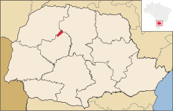
Location in Paraná state
(2020 [1])
87240-xxx
Terra Boa is a municipality in the micro-region of Campo Mourão in the Brazilian state of Paraná. The population is 17,200 (2020 est.) in an area of 320.85 km².[2] The elevation is 825 m. The neighbouring municipalities are Cianorte, Engenheiro Beltrão, Jussara and Peabiru.
References
External links
- http://www.citybrazil.com.br/pr/terraboa (in Portuguese)
- v
- t
- e


