Warrior Mountain

Warrior Mountain
Allegany County, Maryland
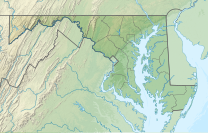
Warrior Mountain is a ridge located in Allegany County, Maryland. Warrior Mountain begins 3 miles (4.8 km) northwest of Oldtown, Maryland and runs northeasterly to the water gap formed by the Murley Branch of Town Creek, 1.25 miles (2.01 km) south of Flintstone, Maryland. North of this gap, the Warrior Ridge runs parallel and to the east of Tussey Mountain north past Everett, Pennsylvania until its ridge line merges with the Tussey Mountain ridge line at the Blair County/Bedford County boundary.
References
- ^ a b "Warrior". NGS Data Sheet. National Geodetic Survey, National Oceanic and Atmospheric Administration, United States Department of Commerce. Retrieved 2011-06-08.
- ^ "Warrior Mountain". ListsOfJohn.com. Retrieved 2011-06-08.
External links
- "Warrior Mountain, Maryland". Peakbagger.com.
- "Warrior Mountain". Geographic Names Information System. United States Geological Survey, United States Department of the Interior.
- v
- t
- e
- Backbone Mountain
- Dans Mountain
- Haystack Mountain
- Negro Mountain
- Roundtop Hill
- Catoctin Mountain
- Elk Ridge
- Lambs Knoll
- Quirauk Mountain
- South Mountain
- Sugarloaf Mountain
This article about a location in Allegany County, Maryland is a stub. You can help Wikipedia by expanding it. |
- v
- t
- e


