Stadlern

Cet article est une ébauche concernant une localité allemande.
Vous pouvez partager vos connaissances en l’améliorant (comment ?) selon les recommandations des projets correspondants.
| Stadlern | |||
 | |||
| Administration | |||
|---|---|---|---|
| Pays |  Allemagne Allemagne | ||
| Land |  Bavière Bavière | ||
| District (Regierungsbezirk) | district du Haut-Palatinat | ||
| Arrondissement (Landkreis) | Schwandorf | ||
| Code postal | 92549 | ||
| Indicatif téléphonique | 09674 | ||
| Immatriculation | SAD | ||
| Démographie | |||
| Population | 517 hab. () | ||
| Densité | 49 hab./km2 | ||
| Géographie | |||
| Coordonnées | 49° 30′ 00″ nord, 12° 37′ 00″ est | ||
| Altitude | 708 m | ||
| Superficie | 1 055 ha = 10,55 km2 | ||
| Localisation | |||
| Géolocalisation sur la carte : Allemagne
Géolocalisation sur la carte : Bavière
| |||
| Liens | |||
| Site web | www.schoenseer-land.de | ||
modifier  | |||


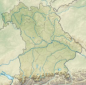
Stadlern est une commune de Bavière (Allemagne), située dans l'arrondissement de Schwandorf, dans le district du Haut-Palatinat.
Communes limitrophes
Communes limitrophes Bělá nad Radbuzou, Rybník nad Radbuzou, Tiefenbach, Weiding, Schönsee.
 Schönsee 7 km |  Bělá nad Radbuzou 19 km | Rybník nad Radbuzou 7 km |
Schönsee 7 km |  | Rybník nad Radbuzou 7 km |
 Weiding 5 km |  Tiefenbach 11 km | Rybník nad Radbuzou 7 km |
Images
-
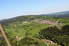 Stadlern.
 -
 Stadlern: Église Ascension-de-Marie.
 -
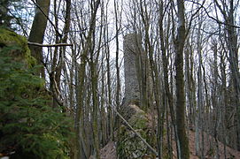 Stadlern: Les ruines du château de Reichenstein.


v · m Villes et communes de l'arrondissement de Schwandorf | ||
|---|---|---|
|  | |
 Portail de la Bavière


