Palo Pinto
| Palo Pinto | |
| CDP | |
 | |
| Land |  USA USA |
|---|---|
| Delstat | Texas |
| County | Palo Pinto County |
| Höjdläge | 328 m ö.h. |
| Koordinater | 32°46′2″N 98°17′55″V / 32.76722°N 98.29861°V / 32.76722; -98.29861 |
| Yta | 2,25 km² (2010) |
| - land | 2,21 km² |
| - vatten | 0,04 km² |
| Folkmängd | 333 (2010) |
| Befolkningstäthet | 151 invånare/km² |
| Tidszon | CST (UTC-6) |
| - sommartid | CDT (UTC-5) |
| ZIP-kod | 76484 |
| Riktnummer | 940 |
| FIPS | 4854876 |
| Geonames | 4717376 |
  Ortens läge i Texas | |
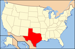 Texas läge i USA | |
Palo Pinto är administrativ huvudort i Palo Pinto County i Texas.[1][2][3] Det ursprungliga ortnamnet var Golconda men namnbytet till Palo Pinto skedde redan år 1858.[4] Enligt 2010 års folkräkning hade Palo Pinto 333 invånare.[5]
Källor
- ^ Texas County Map with County Seat Cities. Geology.com Geoscience News and Information. Läst 21 oktober 2016.
- ^ Profile for Palo Pinto, Texas Arkiverad 22 oktober 2016 hämtat från the Wayback Machine.. ePodunk. Läst 21 oktober 2016.
- ^ Palo Pinto, TX. Map Quest. Läst 21 oktober 2016.
- ^ Palo Pinto, Texas. Handbook of Texas Online. Läst 21 oktober 2016.
- ^ 2010 Census Population of Palo Pinto, Texas Arkiverad 21 oktober 2016 hämtat från the Wayback Machine.. Census Viewer. Läst 21 oktober 2016.
Bilder & media


