Saskatchewan Highway 39
Provincial highway in Saskatchewan, Canada
Major junctions
 Canada-US border (US 52) at North Portal
 Hwy 18 at Estevan
 Hwy 47 at Estevan
 Hwy 35 at Weyburn
 Hwy 13 at Weyburn
 Hwy 6 at Corinne

 Hwy 1 (TCH) / Hwy 301 near Moose Jaw
←  Hwy 38 Hwy 38 | →  Hwy 40 Hwy 40 |
Highway 39 is a provincial paved highway in the southern portion of the Canadian province of Saskatchewan connecting North Portal and Moose Jaw in the north.[2] This is a primary Saskatchewan highway maintained by the provincial and federal governments that provides a major trucking and tourism route between the United States at Portal, North Dakota and the Trans-Canada Highway near Moose Jaw.[3]
Highway 39 is one of Canada's busiest highways, facilitating transport for $6 billion in trade goods via approximately 100,000 trucks over the year.[4] About 71.3 kilometres (44.3 mi) of the highway between Weyburn and Corinne is part of the CanAm Highway[5] route. Other Saskatchewan highways on the CanAm route include 35, 6, 3, and 2.[6][7] Highway 39 is divided, or twinned, in two areas — east of Estevan for 10 kilometres (6.2 mi) to the junction with Highway 18[8] and north-west of Weyburn for 1.7 kilometres (1.1 mi). The junction of Highway 39 with the Trans–Canada divided four-lane highway is done via a partial cloverleaf interchange.
Travel route
Highway 39 begins at the Portal–North Portal Border Crossing, which has Saskatchewan's only duty-free shop.[9] From there, the highway heads north-west towards the Souris River valley. On the south side of the valley, and adjacent to the highway, is the Short Creek Cairn. The cairn commemorates a North-West Mounted Police camp from the 1874 Great March West. The actual camp was located nearby at the mouth of Short Creek on the Souris River near Roche Percee. From the cairn, Highway 39 descends into the valley, which is where the village of Roche Percee and Roche Percee Recreation Site[10] are situated.[11] Roche Percee is named after a geophysical rock formation in the area.[12] Just east of Roche Percee are two arches created by limestone rocks upon which historic animals, and initials are carved. The local Indigenous people found this site to be a power centre. As the highway crosses the river and climbs up and out of the Souris River valley, it passes by two large dragline surface coal mines. With an abundance of coal, the first operational mine opened in 1891. The coal was shipped downstream by barge to Winnipeg until the CPR's Soo Line came through in 1893. Underground mines began being replaced in the 1930s and, by the 1950s, all underground mining had been replaced by dragline surface mines.[13]
From the coal mines, Highway 39 opens up into a divided highway, is joined by, and has a 10-kilometre (6.2 mi) concurrency with, Highway 18, and heads west towards the city of Estevan.[14] At the eastern outskirts of Estevan, Highway 39 diverges north and bypasses the city while Highway 39A continues through it. The 13-kilometre (8.1 mi) Estevan Bypass opened in November 2015.[15]
Estevan is the eighth largest city in Saskatchewan and is known as "The Energy City" as there is an abundance of coal, oil, and natural gas resources near the city. Also nearby is Rafferty Dam, Boundary Dam Power Station, and Shand Power Station.[16] Boundary Dam Power Station is the location of the Boundary Dam Carbon Capture Project.[17] In June 2024, Saskatchewan's premier Scott Moe announced that small modular reactors were coming to Saskatchewan and "that the government was officially looking at just the Estevan area for the first reactor in Saskatchewan."[18]
As the Highway 39 / Estevan Bypass skirts around the northern limits of Estevan, it is intersected by Highway 47. Highway 47 heads north to Stoughton and south through Estevan (intersecting with Highway 39A) to the Noonan–Estevan Border Crossing. Highway 39 is rejoined by Highway 39A north-west of Estevan where continues in a north-westerly direction towards the city of Weyburn. Along the way, the highway provides access to many small communities, such as Hitchcock, Macoun,[19] Midale, Halbrite,[20] and Ralph. This section of highway parallels the Souris River and its reservoirs from Estevan to Weyburn and provides access to two regional parks: Mainprize Regional Park[21] and Nickle Lake Regional Park.[22]
Weyburn, "The Opportunity City", has also been dubbed the Soo Line City due its connection with Chicago on the Soo Line of the Canadian Pacific Railway (CPR).[23] Weyburn is at the crossroads of three major highways — 35, 39, and 13[24][25] and is near the upper delta of the 760-kilometre (470 mi) long Souris River. The Souris River continues south-east through North Dakota eventually meeting the Assiniboine River in Manitoba.[23] In the 19th century, this area was known as an extension of the Greater Yellow Grass Marsh. "Extensive flood control programs have created reservoirs, parks and waterfowl centres along the Souris River."[24][26] Notable points of interest in Weyburn accessible from Highway 39 include the Soo Line Historical Museum,[27][28] Tommy Douglas statue, Weyburn Heritage Village,[29] Water Tower,[30] River Park Campground,[31] and the site of the former Saskatchewan Hospital.
From Weyburn, Highway 39 begins the CanAm section as it continues in a north-westerly direction towards Corinne and Highway 6, at which point it has a 3.7-kilometre (2.3 mi) concurrency with 6. Communities along the stretch of highway from Weyburn to Corinne include McTaggart, Yellow Grass, Lang, and Milestone. At Corinne, the CanAm Highway diverges from Highway 39 and follows Highway 6 to Regina. In 2023, a two-year, $57 million twinning project from the concurrency of Highways 6 and 39 to Regina was begun. The project is split into two sections — the twinning of a 7.1-kilometre (4.4 mi) segment beginning at the Highway 39 and Highway 6 concurrency south-east of Corinne to a point north of Corinne on Highway 6 and a 7.8-kilometre (4.8 mi) twinning of Highway 6 from Highway 306 north to the Regina Bypass.[32]
After Corinne, Highway 39 continues north-west for the final leg of its route to the Trans-Canada Highway. This section provides access to the communities of Wilcox, Rouleau, Drinkwater, and Pasqua. Rouleau was the host town for the popular Canadian sitcom, Corner Gas, which aired from 2004 to 2009. The show was set in the fictional town of Dog River, Saskatchewan.[33] West of the northern terminus along the Trans-Canada Highway is the city of Moose Jaw.
-
 Partial cloverleaf interchange at the Trans-Canada Highway (east–west), Highway 39 (south), and Highway 301 (north)
 -
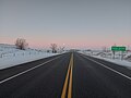 Highway 39 at Roche Percee with mine tailings on either side
 -
 Short Creek Cairn
 -
 Estevan, and the Estevan Coalfield, along the Souris River, viewed from the Space Shuttle, February 2001


CanAm Highway
The 71.7-kilometre (44.6 mi) segment between Weyburn and Corinne is designated as a portion of the CanAm Highway. Near Corinne, Highway 39 is concurrent with Highway 6, at Corinne, the CanAm Highway continues north on Highway 6. South of Weyburn, the CanAm Highway crosses the Canada–United States border via Highway 35. "The projects on Highways 39 and 6 will help to improve traffic flow through these Canada/U.S. ports. 'Highways 6 and 39 are very important to Saskatchewan — serving as tourism links and major north–south trade corridors to the U.S.,' former NDP Highways and Transportation Minister Maynard Sonntag had said in 2004."[34]
History
Saskatchewan's Highway 39 traverses a course on a diagonal from the south–east at the U.S. border to north–west at the Trans-Canada Highway east of Moose Jaw. Originally, the road followed the early surveyed road allowances and the grade of the CPR or Soo Line between the United States border and east of Moose Jaw. Travel along Highway 39 before the 1940s would have been travelling on the square following the township road allowances, barbed wire fencing, and rail lines. As the surveyed township roads were the easiest to travel, the first highway was designed on 90 degree right angle corners as the distance traversed the prairie along range roads and township roads.[35][36]
By 1940, Highway 39 has been straightened out for most of its route and no longer follows the road allowances "on the square".[37] As late as 1955 though, there are still right angle segment of the highway near Corinne as well as south of Estevan to North Portal. At this point, the highway still ran through Roche Percee while now it bypasses the village to the east.[38]
In 1947 and 1948, the highway was paved from North Portal to its junction with Highway 6 at Corinne.[39] However, the paved surface fell into disrepair within a few years; a Leader-Post reporter wrote in 1953 that "practically the entire road, from North Portal through to Corinne is just a mass of large gaping potholes, ruts, and cracks, and in some places the hard surface is gone completely."[39] Saskatchewan Motor Transport association director A.R. Mang blamed the poor condition of the road on a failure to place a suitable "base course", a layer of gravel and clay, between the pavement and the road's earthen base.[40] A 1955 map shows that a segment between Estevan and Lang had reverted to gravel[38] and a 1956 highway map shows the entire segment between Weyburn and Estevan as a gravel highway.[41] These maps also show the segment between Corinne and the junction with the Trans-Canada Highway as gravel. Repairs were carried out at considerable expense,[42] but the situation required temporary bans on heavy traffic[43] and the rerouting of traffic along nearby roads.[39][42]
A trade group called the Soo Line Corridor Association advocates twinning much of Highway 39 and part of Hwy 6 to create a continuous twinned corridor stretching from Regina to North Portal to boost Saskatchewan's trade with the United States.[44] Former premier Lorne Calvert had expressed interest in the proposal.[45]
Over the years, Highway 39 has undergone several resurfacing and improvement projects. Some of those projects include:
- In 2001, 14.4 km (8.9 mi) was resurfaced near Milestone[46]
- In 2003, a further 11 km (6.8 mi) was resurfaced near Milestone[3]
- In 2004, 18.2 km (11.3 mi) north of U.S. border was resurfaced
- In 2004, 7.8 km (4.8 mi) near Yellow Grass was resurfaced[47]
- In 2017, the first major section of twinning was completed east of Estevan
- In 2020, there were multiple projects that improved over 200 km (120 mi) of Highway 39 between North Portal and Rouleau. This project saw 11 new passing lanes, resurfacing, culverts, and various safety upgrades. Highlights of the project include:[48]
- Five sets of passing lanes, 35 km (22 mi) of resurfacing, culvert replacements, and the addition of a intelligent transportation system between Hitchcock and Weyburn
- Four sets of passing lanes and 25 km (16 mi) of resurfacing from McTaggart to Milestone
- 32 km (20 mi) of improvements from Corinne to Rouleau[49]
Major intersections
From south to north:
| Rural municipality | Location | km[1] | mi | Destinations | Notes | |||
|---|---|---|---|---|---|---|---|---|
| Coalfields No. 4 | North Portal | 0.0 | 0.0 |  US 52 east – Minot US 52 east – Minot | Continuation into North Dakota | |||
| Canada–United States border at Portal–North Portal Border Crossing | ||||||||
| 1.1 | 0.68 |   Hwy 604 north Hwy 604 north | ||||||
| | 10.9 | 6.8 |  Hwy 703 west Hwy 703 west | |||||
| | 20.2 | 12.6 | Crosses Souris River | |||||
| Estevan No. 5 | | 23.8 | 14.8 | Roche Percee Access Road | ||||
| | 27.0 | 16.8 |  Hwy 18 east – Bienfait, Oxbow Hwy 18 east – Bienfait, Oxbow | South end of Hwy 18 concurrency | ||||
| Estevan | 33.2 | 20.6 |  Hwy 18 west / Hwy 39A north – City Centre, Torquay Hwy 18 west / Hwy 39A north – City Centre, Torquay | Hwy 39 follows Estevan Bypass; north end of Hwy 18 concurrency | ||||
| 41.1 | 25.5 |  Hwy 47 (Souris Avenue) – City Centre, U.S. border, Stoughton Hwy 47 (Souris Avenue) – City Centre, U.S. border, Stoughton | ||||||
| 46.2 | 28.7 | Hwy 39A south – City Centre | West end of Estevan Bypass | |||||
| Benson No. 35 | No major junctions | |||||||
| Cymri No. 36 | Midale | 80.1 | 49.8 |  Hwy 702 east Hwy 702 east | ||||
| 80.8 | 50.2 |  Hwy 606 – Torquay, Fillmore Hwy 606 – Torquay, Fillmore | ||||||
| Halbrite | 95.0 | 59.0 |  Hwy 705 Hwy 705 | |||||
| City of Weyburn | 122.0 | 75.8 | 16th Street | |||||
| 123.5 | 76.7 | Crosses Souris River | ||||||
| 124.0 | 77.1 |   Hwy 35 (Government Road) – Tribune, U.S. border, Francis Hwy 35 (Government Road) – Tribune, U.S. border, Francis | CanAm Highway south end; CanAm Highway continues along Hwy 35 south | |||||
| 126.5 | 78.6 |  Hwy 13 (Red Coat Trail) – Assiniboia, Carlyle Hwy 13 (Red Coat Trail) – Assiniboia, Carlyle | ||||||
| Weyburn No. 67 | McTaggart | 137.7 | 85.6 | |||||
| Scott No. 98 | Yellow Grass | 150.7 | 93.6 |  Hwy 621 north – Lewvan Hwy 621 north – Lewvan | South end of Hwy 621 concurrency | |||
| | 152.7 | 94.9 | Hwy 621 south | North end of Hwy 621 concurrency | ||||
| Lang | 170.7 | 106.1 | ||||||
| Caledonia No. 99 | Milestone | 184.1 | 114.4 |  Hwy 710 Hwy 710 | ||||
| | 191.5 | 119.0 |  Hwy 6 south – Regway, U.S. border Hwy 6 south – Regway, U.S. border | South end of Hwy 6 concurrency | ||||
| Bratt's Lake No. 129 | Corinne | 194.4 | 120.8 |  Hwy 334 west – Avonlea Hwy 334 west – Avonlea | ||||
| | 195.2 | 121.3 | Hwy 6 north – Regina | CanAm Highway north end; north end of Hwy 6 concurrency; CanAm Highway follows Hwy 6 north | ||||
| Redburn No. 130 | Wilcox | 204.0 | 126.8 | |||||
| Rouleau | 221.4 | 137.6 |  Hwy 714 east Hwy 714 east | Home of Corner Gas at Dog River | ||||
| | 225.8 | 140.3 |  Hwy 623 south – Truax Hwy 623 south – Truax | South end of Hwy 623 concurrency | ||||
| | 227.6 | 141.4 | Hwy 623 north – Pense, Lumsden | North end of Hwy 623 concurrency | ||||
| Drinkwater | 240.8 | 149.6 | ||||||
| Pense No. 160 | | 250.6 | 155.7 |   Hwy 339 south / Hwy 642 north – Claybank, Avonlea Hwy 339 south / Hwy 642 north – Claybank, Avonlea | ||||
| Moose Jaw No. 161 | 263.5 | 163.7 | Hwy 1 (TCH) – Moose Jaw, Swift Current, Regina Hwy 301 north – Buffalo Pound Provincial Park | Interchange; through traffic follows Hwy 301 | ||||
1.000 mi = 1.609 km; 1.000 km = 0.621 mi
| ||||||||
Highway 39A
Highway 39A | |
|---|---|
| Location | Estevan |
| Length | 11 km[1] (6.8 mi) |

Highway 39A is a highway in Saskatchewan serving the city of Estevan. It runs from the Highway 18 / Highway 39 concurrency east of Estevan to Highway 39, north-west of the city. It is the original configuration for Highway 39 through Estevan and was designated after the Estevan Bypass was opened in 2015.[50]
The highway runs concurrently with Highway 18 from it southern terminus east of Estevan along 4th Street, to Souris Avenue where Highway 18 turns south and leaves the concurrency, becoming concurrent with Highway 47. It continues to 13th Avenue where Highway 47 turns north and Highway 39A continues north-west, leaving Estevan to its northern terminus with Highway 39. Highway 39A is about 11 kilometres (7 mi) long.[51]
Major intersections
| Rural municipality | Location | km[1] | mi | Destinations | Notes |
|---|---|---|---|---|---|
| Estevan No. 5 | | 0.0 | 0.0 |  Hwy 18 east / Hwy 39 south – Bienfait, North Portal, U.S. border Hwy 18 east / Hwy 39 south – Bienfait, North Portal, U.S. border | |
| City of Estevan | 5.1 | 3.2 | Hwy 18 west / Hwy 47 south (Souris Avenue) – Torquay, U.S. border | North end of Hwy 18 concurrency; south end of Hwy 47 concurrency | |
| 5.6 | 3.5 | Hwy 47 north (13th Avenue) – Stoughton | North end of Hwy 47 concurrency | ||
| Estevan No. 5 | | 11.2 | 7.0 | Hwy 39 north – Weyburn, Regina | |
1.000 mi = 1.609 km; 1.000 km = 0.621 mi
| |||||
See also
References
- ^ a b c d "Google Maps". Google Maps. Retrieved 24 June 2016.
- ^ "TYPE ADMN_CLASS TOLL_RD RTE_NUM1 RTE_NUM2 ROUTE 1 Gravel ..." Government of Canada. Retrieved 17 February 2008.[permanent dead link]
- ^ a b Government of Saskatchewan. "IMPROVING HIGHWAY 39 NEAR MILESTONE". Archived from the original on 10 June 2011. Retrieved 10 April 2007.
- ^ Infrastructure Canada, Government of Canada (2 October 2006). "Prime Minister Chrétien and Premier Calvert announce $164 million ..." Archived from the original on 12 August 2007. Retrieved 10 April 2007.
- ^ Macdonald, Julian (1999–2003). "Provincial Highways @ Saskatchewan Highways Website". Archived from the original on 15 February 2008. Retrieved 17 February 2008.
- ^ "Western Canada Group Travel Planner: Getting to Western Canada". 1999–2003. Archived from the original on 19 September 2007. Retrieved 17 February 2008.
- ^ Microsoft Streets and Tips (Map) (2004 ed.). Microsoft Corp. § Route Planner.
- ^ "Highway 39 Twinning Project Complete". Saskatchewan. Government of Saskatchewan. 16 November 2017. Retrieved 12 June 2024.
- ^ "Canada Border Services Agency". Government of Canada. 8 April 2008. Archived from the original on 22 May 2011. Retrieved 10 April 2008.
- ^ "Roche Percee Campground". Tourism Saskatchewan. Government of Saskatchewan. Retrieved 11 June 2024.
- ^ "Memories of North Portal and Districts". North Portal 75th Anniversary Committee. 19 April 1979. Retrieved 10 April 2008.
- ^ Fogleman., Larry. "Gallery - Roche Percée, Saskatchewan, Canada". Retrieved 10 April 2008.
- ^ McLennan, David (2006). "Roche Percée". The Encyclopedia of Saskatchewan. CANADIAN PLAINS RESEARCH CENTER, UNIVERSITY OF REGINA. Retrieved 15 February 2008.
- ^ "Estevan". Tourism Saskatchewan. Government of Saskatchewan. Retrieved 17 June 2024.
- ^ "The Estevan Bypass is Officially Open". Saskatchewan. Government of Saskatchewan. 10 November 2015. Retrieved 16 June 2024.
- ^ "Estevan at a Glance". Estevan Library. Southeast Regional Library. Retrieved 16 June 2024.
- ^ "Boundary Dam Carbon Capture Project". SaskPower. Retrieved 16 June 2024.
- ^ "SMR announcement a big win for the Estevan area". SaskTodasy. Glacier Media. 2 June 2024. Retrieved 16 June 2024.
- ^ "Macoun". Tourism Saskatchewan. Government of Saskatchewan. Retrieved 17 June 2024.
- ^ "Halbrite". Tourism Saskatchewan. Government of Saskatchewan. Retrieved 17 June 2024.
- ^ "Mainprize Regional Park and Golf Club". Tourism Saskatchewan. Government of Saskatchewan. Retrieved 15 June 2024.
- ^ "Nickle Lake Regional Park". Tourism Saskatchewan. Government of Saskatchewan. Retrieved 15 June 2024.
- ^ a b Weyburn Writer's Association (2006). "Hey, seeds!". Our Roots Nos Racines. University of Calgary, Université Laval. Archived from the original on 27 May 2011. Retrieved 15 April 2008.
- ^ a b "Canadian Rural Partnership - Rural Development - Public - Private Partnerships in Rural and Northern Canada Study - Appendix C - List of Projects". Government of Canada. 26 September 2005. Archived from the original on 12 November 2007. Retrieved 15 April 2008.
- ^ Adamson, J (5 November 2003). "Canadian Maps: May 1948 Waghorn's Guide. Post Offices in Man. Sask. Alta. and West Ontario". Online Historical Map Digitization Project. Rootsweb. Retrieved 15 April 2008.
- ^ "Water Control - Saskatchewan Dams and Reservoirs". Saskatchewan Watershed Authority. Archived from the original on 1 January 2007. Retrieved 15 April 2008.
- ^ "Soo Line Historical Museum". Tourism Saskatchewan. Government of Saskatchewan. Retrieved 17 June 2024.
- ^ "Soo Line Historical Museum". Canada's Historic Places. Parks Canada. Retrieved 16 June 2024.
- ^ "Weyburn & Area Heritage Village". Tourism Saskatchewan. Government of Saskatchewan. Retrieved 17 June 2024.
- ^ "Water Tower". Weyburn. Weyburn, Saskatchewan - The Opportunity City. Retrieved 16 June 2024.
- ^ "River Park Campground - Weyburn". Tourism Saskatchewan. Government of Saskatchewan. Retrieved 17 June 2024.
- ^ "Highways 6 and 39 Project South of Regina To Resume Construction This Spring". Saskatchewan. Government of Saskatchewan. 25 April 2024. Retrieved 18 June 2024.
- ^ "Corner Gas Online". Pants Online Inc. Archived from the original on 8 March 2008. Retrieved 10 April 2008.
- ^ "Saskatchewan NDP articles". Improving Highways - Weyburn Estevan Area. 3 March 2004. Archived from the original on 12 November 2007. Retrieved 15 April 2008.
- ^ Adamson, J (14 October 2003). "Canadian maps 1926 Highway Map". Department of Highways. Canadian Maps Online Digitization Project. Retrieved 10 February 2008.
- ^ Anderson, Frank w. (1998). The Yellowhead Trail in Manitoba and Saskatchewan. Saskatoon, Saskatchewan: Frank W. Anderson. p. 50.
- ^ "Official road map of Western Canada 1940". Shell. H.M. Gousha Company, Chicago Ill. Archived from the original on 27 September 2007. Retrieved 25 April 2008.
- ^ a b "The Atlas of Canada - Major Roads, 1955". Natural Resources Canada, Earth Sciences Sector, Geomatics Canada. Government of Canada. 19 July 2004. Archived from the original on 14 March 2012. Retrieved 25 April 2008.
- ^ a b c Wenger, Pete (24 June 1953). "Cratered, cracked surface of highway 39 irks public". The Leader-Post. Regina, Saskatchewan. p. 2. Retrieved 18 September 2012.
- ^ Mang, A.R. (10 September 1953). "Sub-grade carries the load". The Leader-Post. Regina, Saskatchewan. p. 15. Retrieved 18 September 2012.
- ^ Shell Map of British Columbia, Alberta, Saskatchewan and Manitoba (Map). 1:2,471,040. Shell Oil Company. 1956. Retrieved 18 September 2012.
- ^ a b "Per mile cost of highway 39 exceeds Trans-Canada figure". The Leader-Post. Regina, Saskatchewan. 8 September 1955. p. 2. Retrieved 18 September 2012.
- ^ "Temporary repair work improves No. 39 highway". The Leader-Post. Regina, Saskatchewan. 24 April 1952. p. 2. Retrieved 18 September 2012.
- ^ "Group wants better U.S. connection". The Leader-Post. Regina, Saskatchewan. 13 March 2008. Archived from the original on 24 September 2015. Retrieved 18 September 2012.
- ^ "Premier likes Soo Line twinning plan". The Leader-Post. Regina, Saskatchewan. 14 August 2007. Archived from the original on 12 May 2014. Retrieved 18 September 2012.
- ^ Government of Saskatchewan. "RESURFACING SET FOR HIGHWAY 39". Archived from the original on 25 November 2010. Retrieved 10 April 2007.
- ^ https://www.saskatchewan.ca/government/news-and-media/2004/august/30/improving-highway-39-north-of-the-us-border
- ^ https://www.sasktoday.ca/southeast/local-news/work-begins-on-multiple-projects-for-highway-39-4149575
- ^ https://www.discoverestevan.com/articles/lengthy-delays-coming-as-highway-39-construction-begins
- ^ "The Estevan Bypass is Officially Open". Government of Saskatchewan. 10 November 2015. Retrieved 8 September 2017.
- ^ AOL (9 September 2017). "Highway 39A in Saskatchewan" (Map). Mapquest. AOL. Retrieved 9 September 2017.
External links
KML file (edit • help)
Template:Attached KML/Saskatchewan Highway 39
KML is from Wikidata
- Big Things of Canada, A Celebration of Community Monuments of Canada
- Fading Town of Pasqua, Saskatchewan
- Saskatchewan Highways Website—Highway Numbering
- Ralph, Saskatchewan
- Saskatchewan Road Map Travel Guide: #39 Canada / United States Border To City of Moose Jaw
| Preceded by | CanAm Highway Hwy 39 | Succeeded by |
- v
- t
- e
- 600
- 601
- 602
- 603
- 604
- 605
- 606
- 607
- 608
- 609
- 610
- 611
- 612
- 613
- 614
- 615
- 616
- 617
- 618
- 619
- 620
- 621
- 622
- 623
- 624
- 626
- 627
- 628
- 629
- 630
- 631
- 632
- 633
- 634
- 635
- 636
- 637
- 638
- 639
- 640
- 641
- 642
- 643
- 644
- 645
- 646
- 647
- 648
- 649
- 650
- 651
- 653
- 654
- 655
- 656
- 657
- 658
- 659
- 660
- 661
- 662
- 663
- 665
- 665
- 667
- 668
- 669
- 670
- 671
- 672
- 673
- 674
- 675
- 676
- 677
- 678
- 679
- 680
- 681
- 682
- 683
- 684
- 685
- 686
- 687
- 688
- 689
- 690
- 691
- 692
- 693
- 694
- 695
- 696
- 697
- 698
- 699
- 700
- 701
- 702
- 703
- 704
- 705
- 706
- 707
- 708
- 709
- 711
- 713
- 714
- 715
- 716
- 717
- 718
- 719
- 720
- 721
- 722
- 724
- 725
- 726
- 727
- 728
- 729
- 730
- 731
- 732
- 733
- 734
- 735
- 737
- 738
- 740
- 741
- 742
- 743
- 744
- 745
- 747
- 748
- 749
- 751
- 752
- 753
- 754
- 755
- 756
- 758
- 759
- 760
- 761
- 762
- 763
- 764
- 766
- 767
- 768
- 769
- 771
- 772
- 773
- 774
- 776
- 777
- 778
- 779
- 780
- 781
- 782
- 783
- 784
- 785
- 786
- 787
- 788
- 789
- 790
- 791
- 792
- 793
- 794
- 795
- 796
- 797
- 798
- 799


